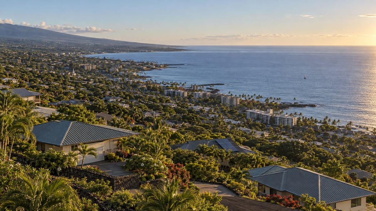
Most buyers who come to us interested in South Kona are thinking about Captain Cook. That is the right instinct. Captain Cook is the name people actually use for the stretch of communities along Māmalahoa Highway between roughly mile marker 106 and the Kealakekua area. Kealakekua is the name on the post office and on the hospital, and it shows up in real estate searches too. For practical purposes, when someone says they want to live near Kealakekua Bay or in the coffee belt above the coast, they are talking about the same general area.
What makes South Kona worth understanding carefully is that it is not one neighborhood. It is a series of hillside communities at different elevations, with different access to water, utilities, and town services, and with meaningfully different trade-offs depending on what kind of property you are looking for. The choice is less about street names and more about how you want to live.
Key Takeaways
- Captain Cook and Kealakekua refer to the same general area in South Kona — use both terms when searching.
- Most homes sit between 800 and 2,000 feet elevation, which means cooler temperatures, more clouds, and regular afternoon showers compared to the Kona coast below.
- Drive time to downtown Kona runs roughly 20 to 30 minutes; Kona International Airport is 30 to 40 minutes depending on your address.
- Agricultural zoning is common — many properties include coffee trees, macadamia groves, or farm elements, which affects permitted uses and resale considerations.
- Water and waste systems vary significantly by parcel. County water, rain catchment, and septic are all common. Confirm at the property level before writing an offer.
- Lava flow hazard zones apply in parts of South Kona. Know which zone a specific parcel sits in before you get attached to it.
What the Elevation Actually Means
Captain Cook sits in the Kona coffee belt, roughly 800 to 2,000 feet above sea level. That elevation is what makes South Kona feel different from the coast. Mornings are often clear with long ocean views, and afternoons bring clouds and occasional showers that keep everything green. It is noticeably cooler at night than down in Kailua-Kona, which many buyers find comfortable and others find surprising after expecting year-round resort weather.
The tradeoff is that you are not walking to the beach. Kealakekua Bay is accessible from Route 160, which drops steeply from the highway toward the coast, but shore access at the bay itself is managed and limited. Most residents drive to their ocean time rather than having it out the front door. If daily beach access is a priority, the coastal areas of Kona are a better fit. If what you want is space, views, cooler nights, and the feel of living in working farm country, South Kona delivers that in ways the coast does not.
What to Expect From the Land
Properties in this area tend toward larger lots with agricultural character. Single-family homes range from plantation-era cottages to mid-century ranches to newer ocean-view builds, and many sit on parcels with coffee trees, macadamia groves, or mixed agricultural use already in place. That adds privacy, a farm feel, and outdoor living space that is hard to find at the same price point on the coast.
Agricultural zoning is the thing buyers most often underestimate. Before writing an offer on any South Kona property, confirm any agricultural dedications on the parcel, what uses are permitted, and whether there are any division restrictions. These details are in county records and are worth pulling early rather than finding out during escrow. A thorough review at the start saves real headaches later.
Leasehold versus fee simple also comes up more often in South Kona than buyers expect. If you are looking at a property with leasehold title, make sure you understand the lease terms and how they affect financing. Some lenders have specific requirements or limitations for leasehold properties that can affect your options. Our post on leasehold versus fee simple covers what Kona buyers need to know.
Utilities Are Not a Given Here
This is the piece that catches mainland buyers off guard more than anything else in South Kona. Water and waste systems are not standardized. Some properties connect to county water. Others rely entirely on rain catchment systems, where the roof collects rainwater into storage tanks that supply the house. Septic systems rather than sewer connections are common on rural lots. None of this is unusual for the area, but it does affect maintenance costs and inspection requirements in ways a standard mainland home purchase would not.
For rain catchment properties specifically, the inspection should include water quality testing, storage capacity, roof and gutter condition, and the pump and filtration system. For septic, confirm the age, permitted status, and when it was last serviced. These are not deal-killers, but they need to be on the checklist from day one rather than discovered at the end of escrow.
Broadband and cell coverage also vary more than buyers expect. Many parts of Captain Cook have cable or DSL, but fiber is not universal and some rural parcels rely on fixed wireless or satellite. If you work remotely, check address-level availability before you get serious about a specific property.
Kealakekua Bay and the Coast
Kealakekua Bay is one of the best snorkeling spots on the island and a significant draw for South Kona buyers. The bay is a Marine Life Conservation District, which means access is managed and shore entries are limited. Most people reach the bay by guided kayak or boat tour, or via the steep hike down from the trailhead. It is worth knowing before you buy expecting easy daily access that casual drop-in visits are not how most residents approach it.
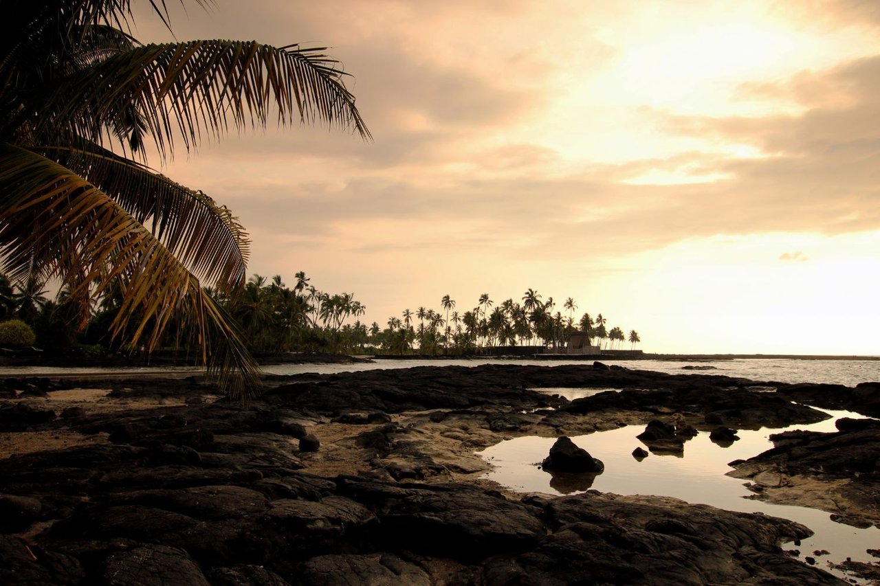
South along the coast, Pu'uhonua o Honaunau National Historical Park is one of the island's most significant cultural sites. The snorkel entry adjacent to the park known as Two Step is a local favorite for calm, clear water when conditions cooperate. No lifeguards, limited parking, and worth knowing before you show up.
Hazard Zones and Insurance
Parts of South Kona sit within USGS lava flow hazard zones. Captain Cook addresses are primarily in Zone 2, which covers areas adjacent to and downslope of the active rift zones of Mauna Loa. That matters for insurance availability, lender requirements, and long-term planning. Identify a property's hazard zone early in your search, not after you have written an offer. It should be one of the first questions, not an afterthought.
Coastal flood and tsunami zone information applies if you are looking at anything near the shoreline. Know the evacuation routes from any property you are seriously considering, especially if you plan to rent it or have guests who may not know the area.
Who South Kona Is Actually Right For
South Kona is not the right fit for every buyer, and that is worth saying plainly. If you want to be five minutes from Costco, a broad restaurant scene, and resort amenities, you want to be in Kona town or Keauhou. If you want a quieter pace, room for a garden or small farm operation, views that most people only see on vacation, and a community that runs on farmers markets and local produce stands rather than big-box stores, South Kona makes a compelling case.
The buyers who are happiest here tend to be people who did their homework on utilities and zoning, understood what the drive to town actually looks like, and bought with realistic expectations about what rural Hawaii requires in terms of property maintenance. The ones who struggle are usually the ones who underestimated one of those three things.
Frequently Asked Questions
What is the difference between Captain Cook and Kealakekua?
They refer to the same general area in South Kona. Captain Cook is the name most people use locally and in real estate searches. Kealakekua is the name used for the post office, the hospital, and the famous bay. Both names show up in MLS listings and both are worth using when searching for properties in this area.
How far is Captain Cook from Kailua-Kona?
Plan roughly 20 to 30 minutes to downtown Kona from most Captain Cook addresses, and 30 to 40 minutes to Kona International Airport. The drive follows Māmalahoa Highway north, which winds through several village areas. Build in extra time for early morning flights or school-day traffic near village centers.
What should I know about water systems on South Kona properties?
Water supply varies significantly by parcel. Some properties connect to county water, while many rural homes use rain catchment systems that collect and store rainwater on-site. Septic systems rather than sewer connections are common. Before writing an offer, confirm the water source, storage capacity, and system condition. For catchment properties, include water quality testing and a full inspection of the roof, gutters, and filtration system.
What are lava flow hazard zones and do they affect South Kona properties?
The USGS maps Hawaii Island into lava flow hazard zones numbered 1 through 9, with lower numbers indicating higher risk. Captain Cook is primarily in Zone 2, which covers areas adjacent to and downslope of the active rift zones of Mauna Loa. The zone affects insurance options, lender requirements, and long-term risk planning. Ask about the specific parcel's hazard zone at the beginning of your search, not after you have fallen in love with a property.
Are there agricultural restrictions on South Kona properties?
Yes, and they matter more than buyers often expect. Agricultural zoning is common throughout South Kona, and some parcels carry agricultural dedications that affect permitted uses, division rights, and resale considerations. Review county zoning and any recorded dedications on a specific parcel before writing an offer. Your agent should pull these records early in the process.
Can you snorkel at Kealakekua Bay from shore?
Shore access at Kealakekua Bay is limited and managed. The bay is a Marine Life Conservation District and the main monument area is reachable only by boat or a steep hike. Most visitors and residents use guided kayak or boat tours to access the best snorkeling areas. Two Step, near Pu'uhonua o Honaunau to the south, offers a more accessible ocean entry on calm days, though there are no lifeguards and parking is limited.
If you are seriously considering South Kona, the right move is to get specific early — about the parcel, the utilities, the zoning, and the hazard zone — rather than falling in love with a view and sorting out the details later. That is where having a team with local knowledge pays off. Reach out to us at Kona Homes for Sale or call 808-854-5432.
Mark Davis, Esq. is a licensed real estate broker (RB-23769) with Kona Homes for Sale at Coldwell Banker Island Properties, Kailua-Kona, Hawaii. He practiced as a transactional and litigation real estate attorney for 35 years before moving to the Big Island full time. He currently serves as a member of the Hawaii County Real Property Tax Board of Appeal. Brenda Kuessner holds the ABR, CRS, e-PRO, GRI, and GREEN designations and has sold real estate on the Big Island for 35 years. Together they serve buyers and sellers across the Kona and Kohala Coast market. This post is for general informational purposes only and does not constitute legal or tax advice.